The first AI-powered road safety platform
StreetVision combines behavioral analytics with geospatial intelligence to support proactive road safety decisions. It helps transportation and road safety professionals understand where risk is emerging, why it occurs, and which actions will have the greatest impact.
Measure the driving behaviors that lead to crashes
See exactly where danger is building across your network
Pinpoint the roads and intersections that need attention most
Invest in interventions backed by analytics
Prove your safety programs are making a difference
0
people die on U.S. roads every year
Despite advances in vehicle safety, road fatalities haven't changed. It's time for a new approach.
Shifting from reactive to proactive road safety
Streets are more complex than ever, with more vulnerable road users, expanding bike lanes, quieter EVs, and heavier vehicles all sharing the same space.
Most safety strategies are reactive by design, analyzing crashes after the fact and hoping interventions prevent the next one. But how do we get ahead of the problem before the next crash happens?
A More Proactive Approach
To reduce crashes and fatalities, agencies need better visibility into the behaviors that lead to risk, not just the crashes that follow. With StreetVision, you get predictive, behavior-based analytics to identify emerging risk patterns, support more informed investment decisions, and provide earlier insight into whether safety efforts are working.
Identify Risk. Save Lives.
Predict Road Risk
It's hard to understand road risk across an entire network. Roadside observations and cameras can only cover so much. StreetVision changes that. It gives you near-real-time visibility into the behaviors that lead to crashes, across every corridor and intersection in your network.
- Analyze behaviors that lead to crashes
- Evaluate intersection risk
- Conduct speed studies
- Assess school and pedestrian zone safety
- Compare community risk
Plan Impactful Countermeasures
Target the strategies that will reduce measured risk and prevent future crashes. Focus infrastructure improvements, enforcement, and education where they will have the greatest impact.
Prove Your Impact
Measure results and clearly report outcomes across programs and plans. Track risk reduction at intersections, corridors, work zones, and communities.
- Measure impact before, during, and after safety programs
- Visualize behavior change by time of day and day of week
- Track trends over time


You know these roads.
Here's what you don't know.
StreetVision maps behavioral risk across every road in your network. Hard braking. Speeding. Distraction. The signals that show up before crashes do. No sensors to deploy. No observations from the field. Just a clear picture of what's happening.
Trusted by agencies across the country
With StreetVision, we can measure risky driving across Texas communities every day. We can take action before the next crash happens.
Texas Department of Transportation
StreetVision gives us superior coverage and accuracy with distraction analytics across Washington. We're also able to use it for speed analytics without deploying trailers or installing sensors.
Washington Traffic Safety Commission
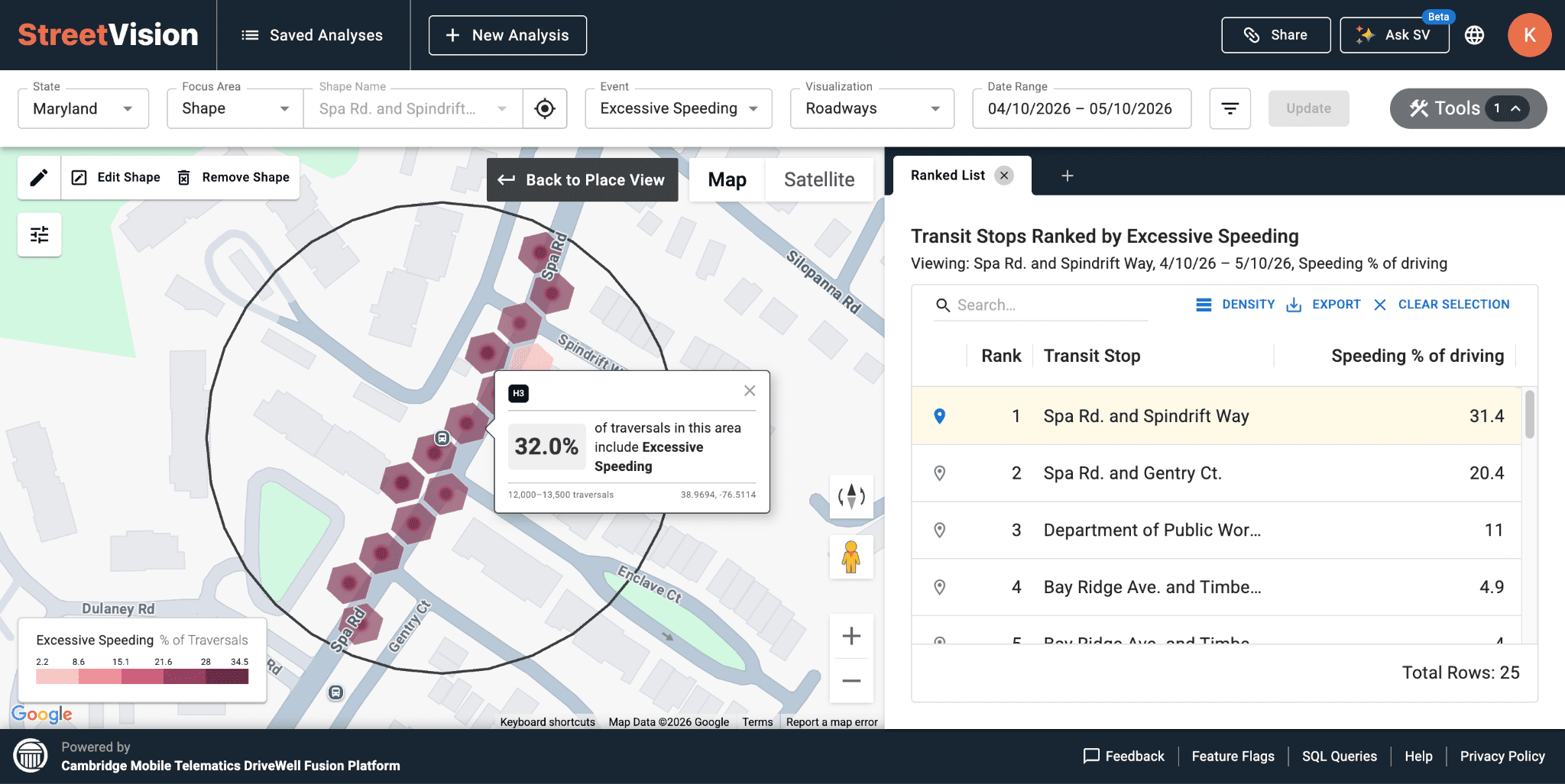
StreetVision has helped us identify speeding hotspots and position more effective countermeasures, giving us faster, clearer insights to act before crashes happen.
Wyoming Department of Transportation


The new standard in proactive road safety
Quickly identify high-risk intersections and corridors before crashes happen with AI-generated predictive insights that eliminate time-consuming data preparation and analysis.
Proprietary in-vehicle sensing mobile app and IoT devices collecting 1,000s of behavioral driving measurements per second.
Seamless integration into existing workflows requiring no specialized training to generate, save and share map visualizations, hotspot risk assessments and impact analysis.
National coverage from millions of opt-in drivers per month across all road classifications and numerous car types and ages.
Create custom geographic focus areas to compare behaviors across counties, municipalities and road segments and incorporate contextual data such as historical crashes and work zones.
Enhance HSIP Strategic Highway Safety Plan updates, NHTSA National Priority Safety Programs and SS4A Action Plans with evidence-based safety interventions.
Road safety insights
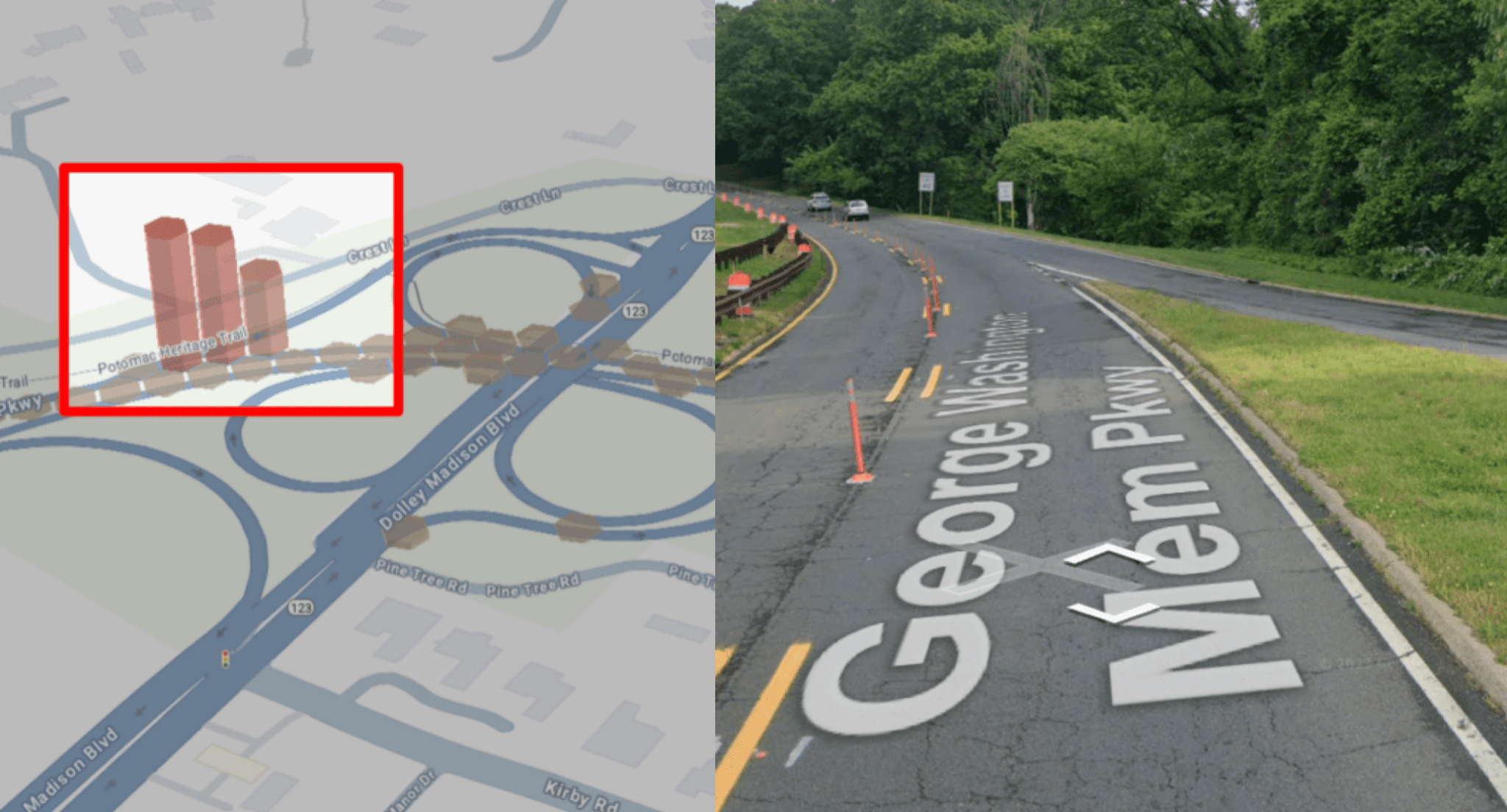
Spot Work Zone Risk Early. Protect Drivers and Workers.
Read article →
How to Find and Fix Hidden Risk in School Zones
Read article →
Are Roundabouts Safer? New Data Shows They Are
Read article →Get road safety insights in your inbox
New data, research, and analysis from the StreetVision team.
StreetVision: The Future of Roadway Safety
You know your roads. Here’s what you don’t know.
See how AI behavioral analytics can help you understand where risk is emerging, why it occurs, and what to do next.