Predict & Prevent Car Crashes
![]()
Where Proactive Road Safety Begins
StreetVision uses AI and behavioral analytics to reveal risky driving hotspots before crashes happen — so you can prioritize projects, select countermeasures, and see what worked faster than ever.
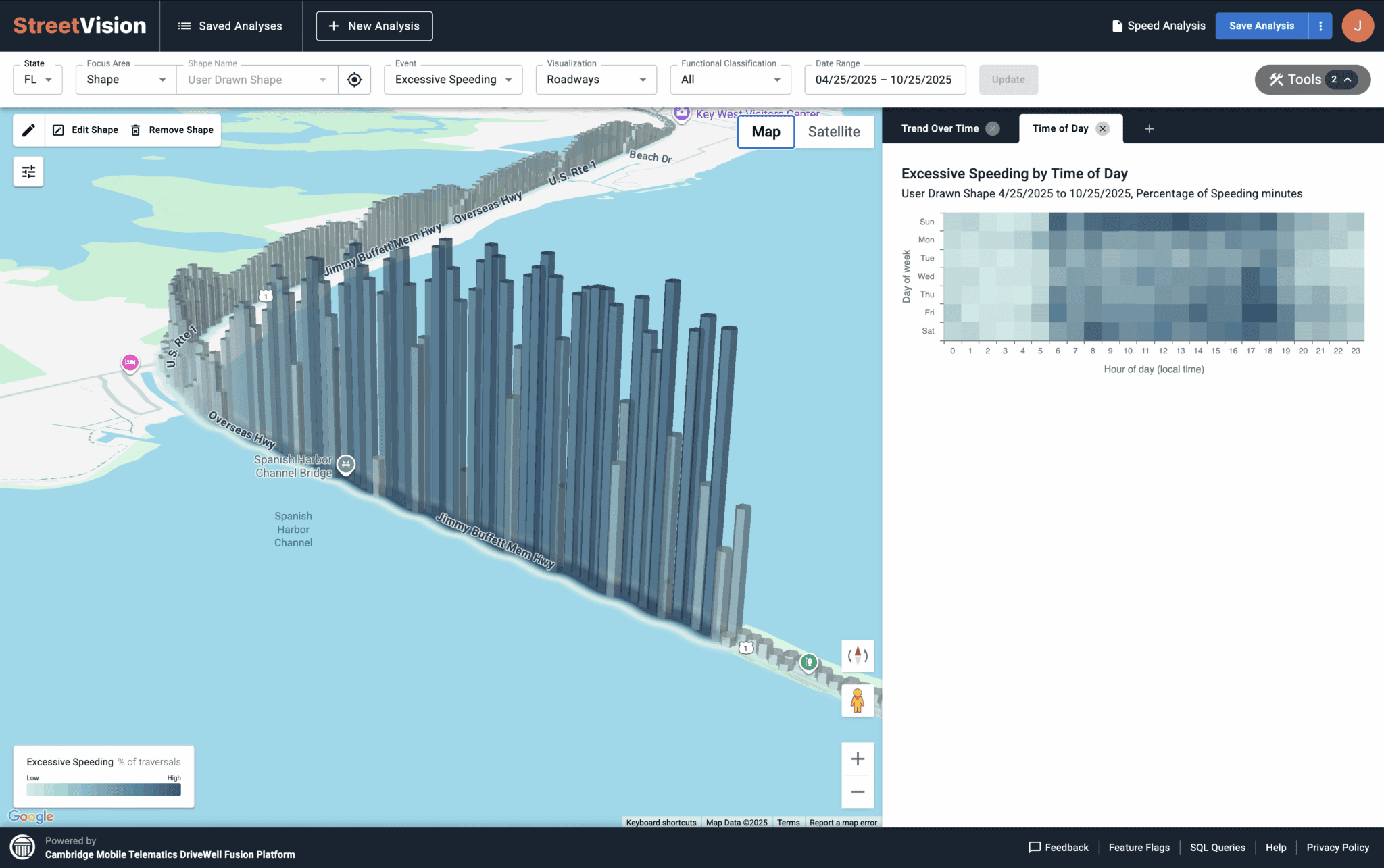
Identify danger using predictive analytics to see risk before it becomes a crash. See real driving behaviors like hard braking, distraction, and speeding, and measure risk in near real time across every road in your network.
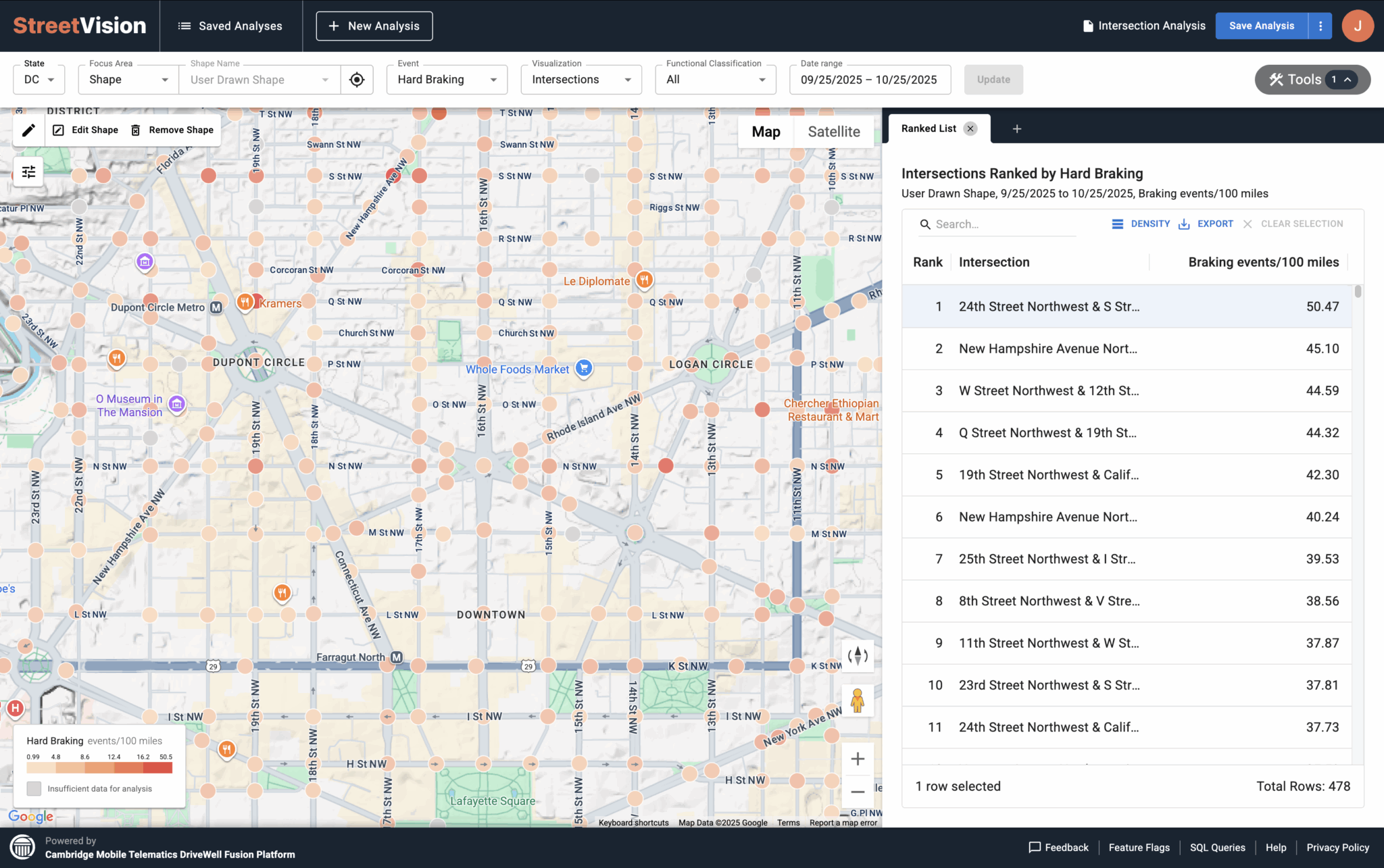
The riskiest roads aren’t always the ones with the most crashes or community complaints. StreetVision helps you identify blind spots and rank intersections and corridors based on predictive risk in order to prioritize improvements and countermeasures.
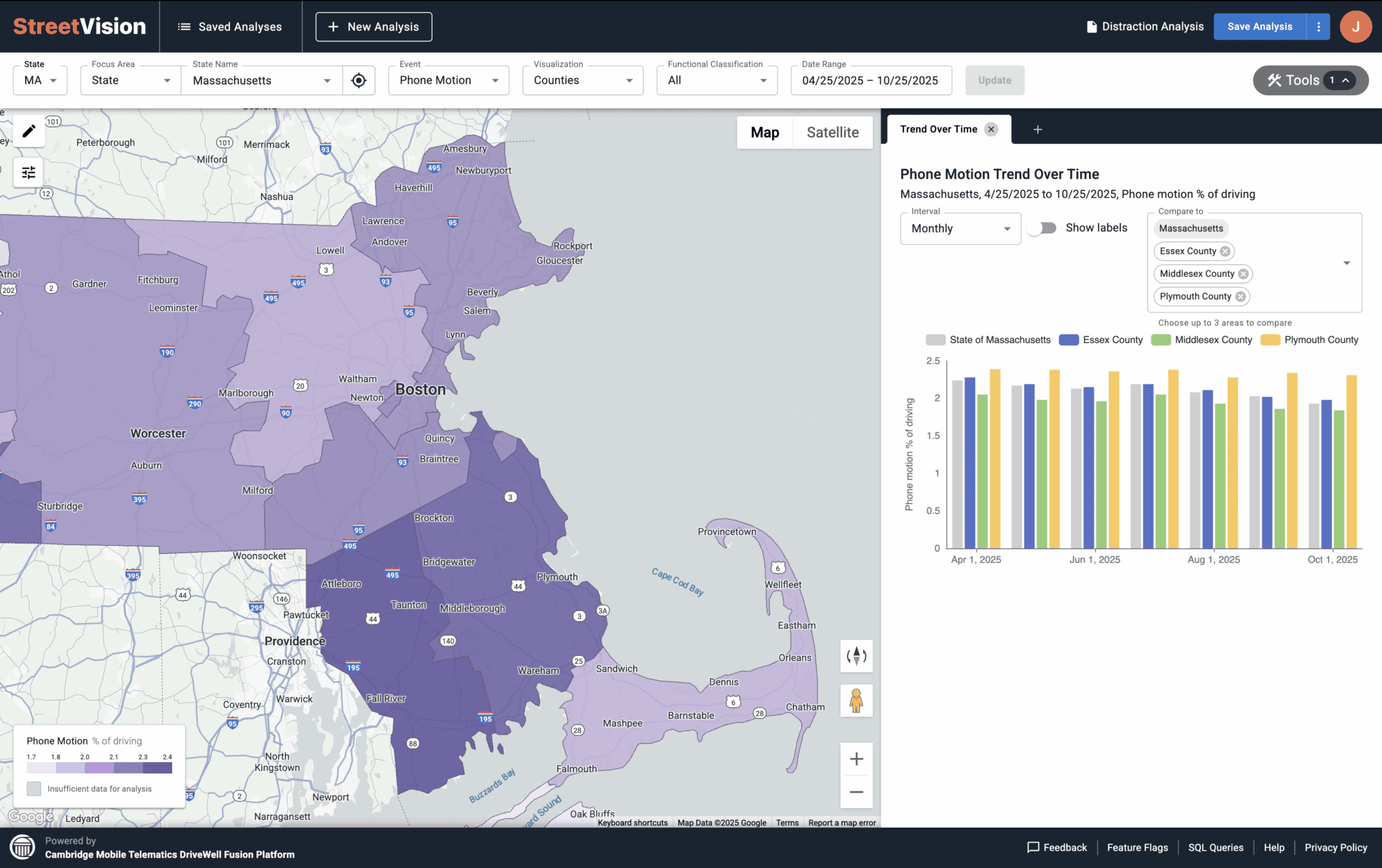
It’s hard to prove something worked when your primary metric is future crashes, which can take years to understand. StreetVision provides daily updates on how risky driving changes over time, with trend, time of day, and before & after charts so you can see what really worked.
Turn Insights into Safer Roads
Transportation agencies are already making roads safer with StreetVision


StreetVision Helps You Make Roads Safer
Road Safety Leaders Rely On it
"Just like DUI was in the past, distracted driving is under reported. Now with StreetVision, we can measure risky driving across Texas communities every day. By getting us upstream of crashes — finding risks before they show up in crash reports — we can take action before the next crash happens."
– Jim Markham | Director, Crash Data & Analysis Section, Traffic Safety Division, Texas Department of Transportation

“With StreetVision, we now have analytics we never had before to measure risk on dangerous roadways and in work zones. The platform has helped us identify speeding hotspots and position more effective countermeasures, giving us faster, clearer insights to act before crashes happen.”
– Karson James | Highway Safety Behavioral Grants Program Manager at the Wyoming Department of Transportation.

“Compared to roadside observation surveys, StreetVision gives us superior coverage and accuracy with distraction analytics across Washington. We’re also able to use it for speed analytics without deploying trailers or installing sensors, which expands our reach while reducing costs. And with daily insights, we can measure the impact of countermeasures, like speed cameras in school zones, almost immediately.”
– Staci Hoff | Research Director at the Washington Traffic Safety Commission
